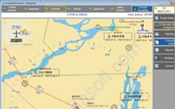
 Haven’t you heard about Electronic Flight Bag yet ? Imagine one tool for your pre-flights tasks : planning, check-lists, weather info, docs library..
“AivlaSoft GmbH is proud to announce a new update to their award-winning utility Electronic Flight Bag (EFB) for Microsoft FSX.”
“EFB version 1.2.0 incorporates many enhancements to existing charting, route planning, and checklist facilities while adding three major new features: “vertical view” Approach Profile Charts, a Flight Information System, and airport METAR decoding.
AivlaSoft continues to support its customers by providing this major update free of charge.
About EFB
AivlaSoft GmbHÂ’s Electronic Flight Bag provides flight-simulator pilots with route planning, flightlog recording, checklist management, and chart viewing functions for professional flight planning and situational awareness capabilities.
Dividing the typical flight into specific segments – Origin Ground, Departure, Enroute, Arrival, Approach, and Destination Ground, EFB is able to provide segment-specific checklists and SID / STAR / Approach charts taken from dedicated Navigraph FMS data. (AIRAC 1003 is provided for free with EFB.)
EFB 1.2.0 is available for immediate download from http://www.aivlasoft.com/ as a cumulative update for current owners . For those who have not yet tried EFB, a fully-functional 30-day trial version can be downloaded then converted to a registered version by simple purchase of a license key. Editors who require a longer period for evaluation can email support@aivlasoft.com for a complimentary review license.
Going vertical
For flight simulation users who are familiar with Jeppesen- or NACO-formatted Instrument Approach Procedure charts, AivlaSoft EFB now provides the Approach Profile View for all documented approaches. From the IF, on through the FAF and MAP, down to the TDZ, pilots can plan (and track in moving-map mode) their descents. All related radio navigational aids – including approach markers – are also included.
HowÂ’s the weather?
To better assist in Departure and Approach planning, EFB allows easy access to decoded METARs using weather data from FSX, real-time online from the National Oceanic and Atmospheric Administration, as well as from locally-stored data files downloaded by Active Sky or Real Environment Xtreme weather engines.
Flying trans-oceanic cargo or passengers to Bologna? Know what your dispatch controllers will advise even before you reach Eurocontrol airspace.
Are we there yet?
EFB’s new Flight Information System acts as a mini Flight Management Computer display for any aircraft – from Cub to Concorde – constantly updating critical aircraft and route information. Data such as current fuel flow, maximum flying time, the next descent altitude constraint, and ETAs for the next waypoint and the destination can be shown on the EFB screen.
No FMC programming required; itÂ’s all automatic!”

