


Quick Summary: In the past Pacific Island Simulations have given us some excellent scenery in the remote Pacific Ocean and now after producing the stunning Ingalls Field have now developed VFR Appalachia.  It covers most of what is called Appalachia in the USA, and includes 6 rural and remote airfields. This is bush flying in mountain scenery at its best with rolling hills, mountains abundant trees, local vegetation, a plethora of custom objects, lots of background noise, static and animated animals and birds aplenty. Appalachia is a very beautiful part of the States and it has been modelled to close to perfection in this PIS rendering. As I have written on previous occasions, every time you open this scenery you will discover something new.
VFR APPALACHIA – The Moonshining Review. (or for the obtuse the Sissy Spacek review)
Installation: Just click on the exe file enter the key code and it installs in the FSX\Simmarket\VFR Appalachia folder ≈1.0 Gb. It activates itself in the scenery folder so after installation it is ready to go. Again, I did not notice any performance decrease on my system, and all was smooth as silk during testing.
Background: Courtesy of Wikipedia;
Appalachia is a region in the eastern United States that stretches from the Southern NY State to Northern Alabama, Mississippi, and Georgia.  The actual Appalachian Mountains (aka Allegheny Mountains) stretch from Belle Isle in Canada to Cheaha Mountain in Alabama, the region of Appalachia usually refers only to the central and southern portions of the range.  The population of Appalachia is ≈23 million people and its size is around 205,000-square-miles (531,000 sq km) [nearly the same size as France!]. The precise area that Appalachia occupies has been defined and re-defined many times and the latest description (which may or may not be current) states that it encompasses 420 counties and 8 independent cities in 13 states, including all or parts of, West Virginia, NY State, Pennsylvania, Ohio, Maryland, Kentucky, Virginia, North Carolina, Tennessee, South Carolina, Georgia, Alabama, and Mississippi. The PIS version of Appalachia covers airfields and scenery in Pennsylvania, Maryland West Virginia and Virginia. Appalachia is an area of great natural beauty and is endowed with abundant natural resources, and the main industries are or have been, logging, manufacturing, coal mining electricity supply, farming, and of course tourism.
The Manual:
There is one manual 10pp long in pdf format. The manual is reasonable, covering the background, objectives, feature, system requirements, recommended FSX settings and details of the airfields/airports included.
In the Sim:
The scenery area is loaded automatically so to initiate a flight you just put your plane at any of the 8 airports included in the scenery — set the weather and you are flying.
Airfields (active and de-comissioned):
The eight airfields comprise:
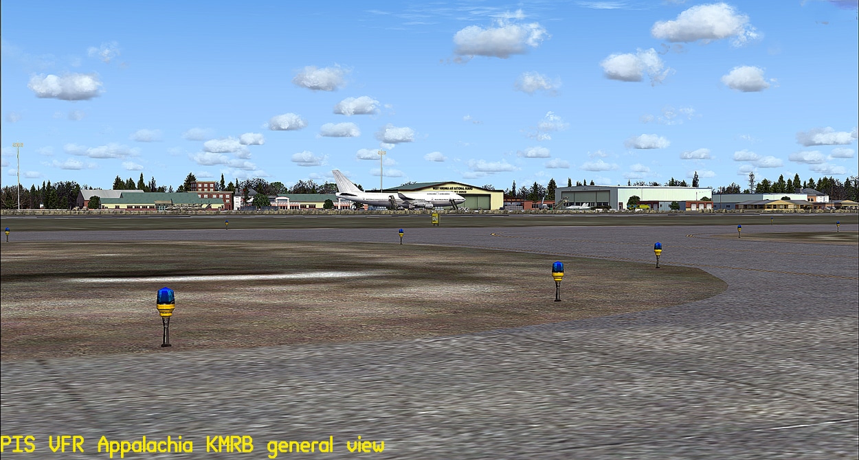
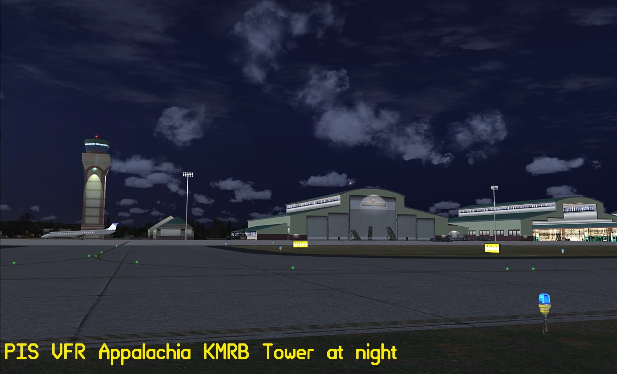
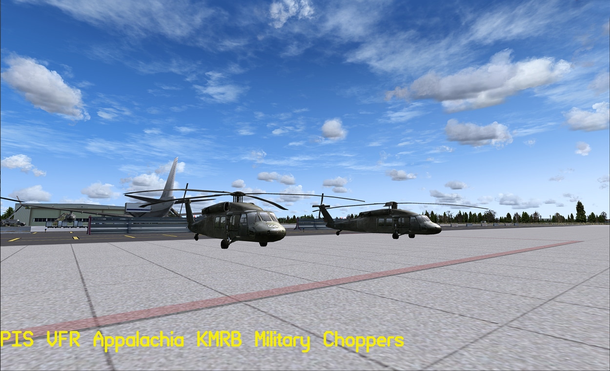
- Eastern West Virginia Regional Airport/Shepherd Field (KMRB), West Virginia
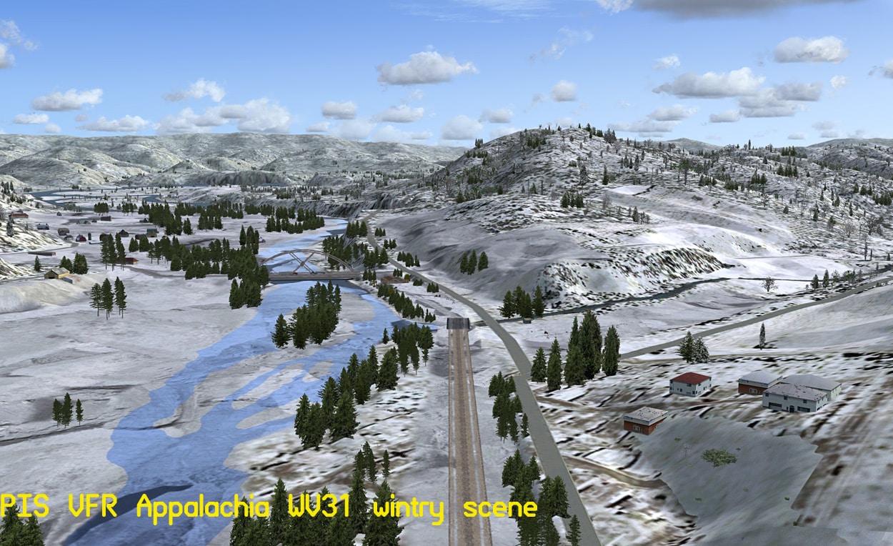
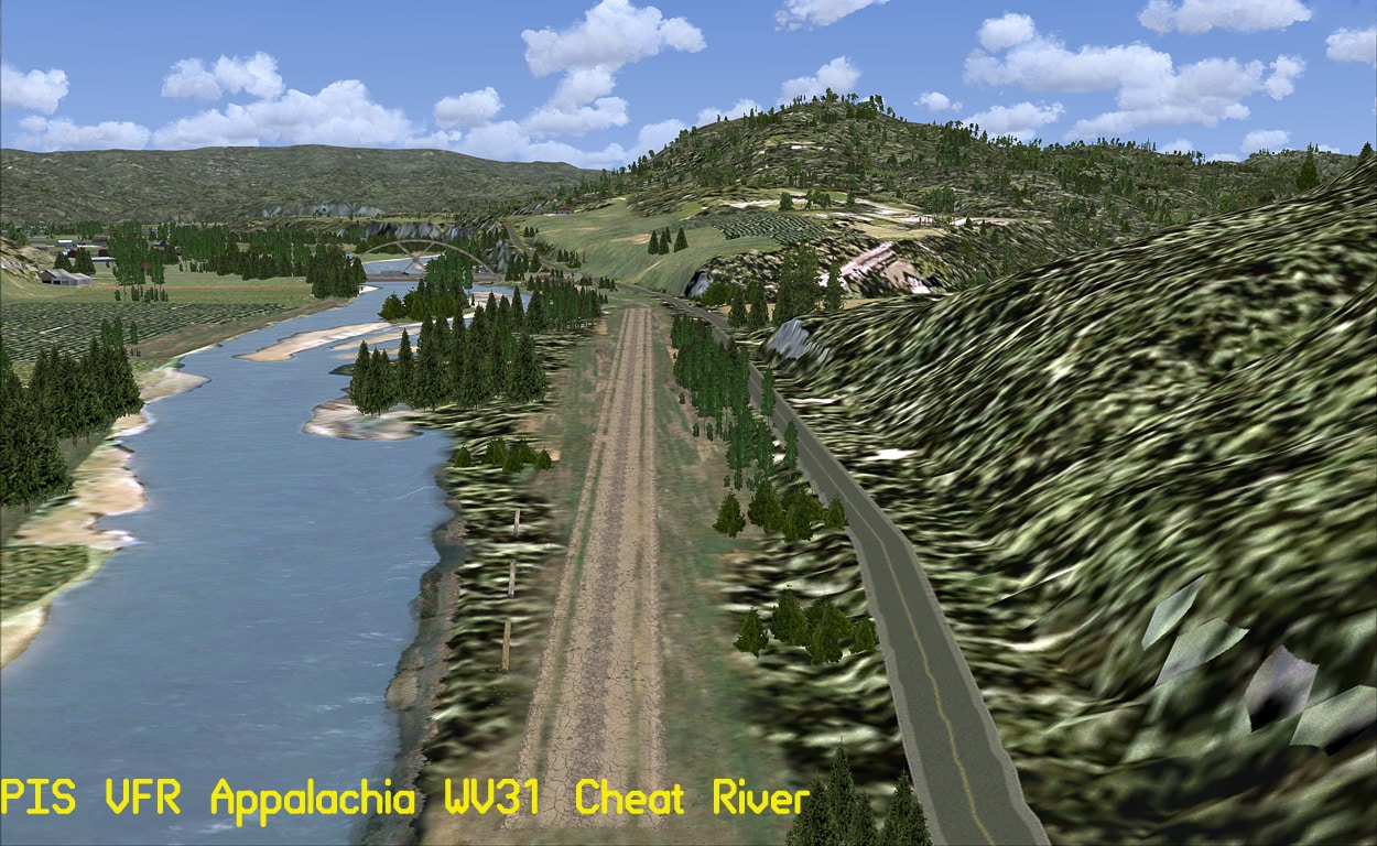
- Cheat River (WV31), West Virginia
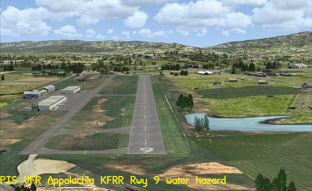
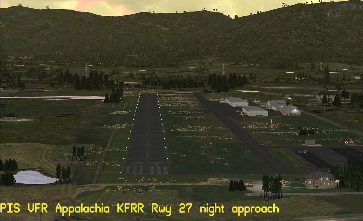
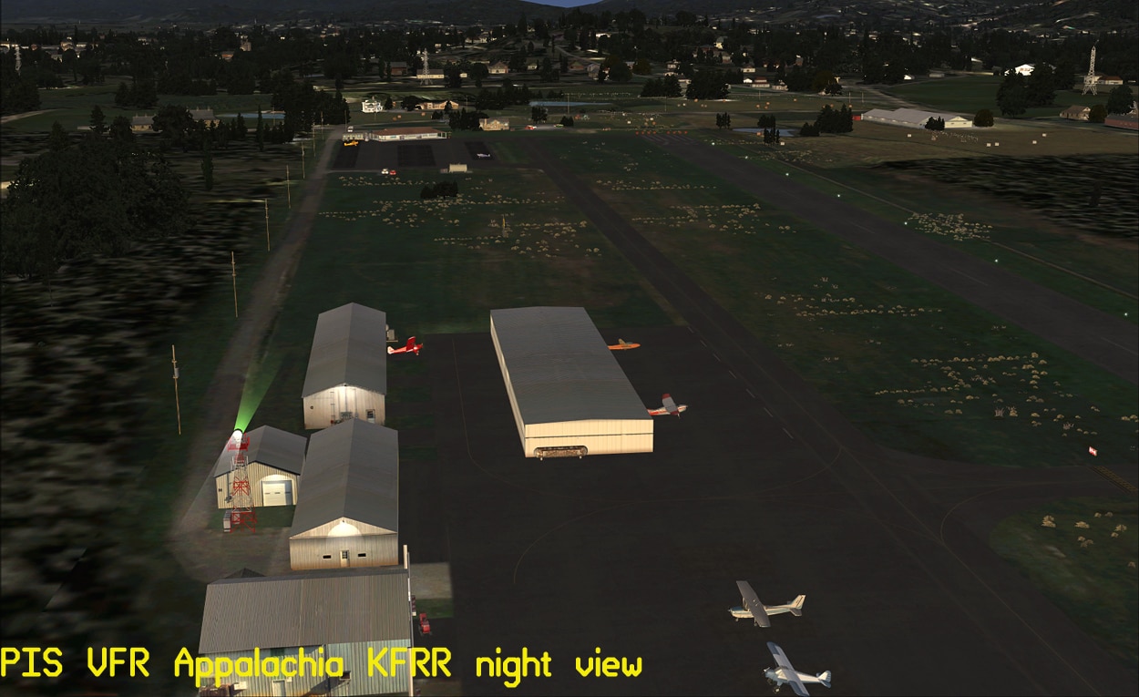
- Front Royal (KFRR), Virginia
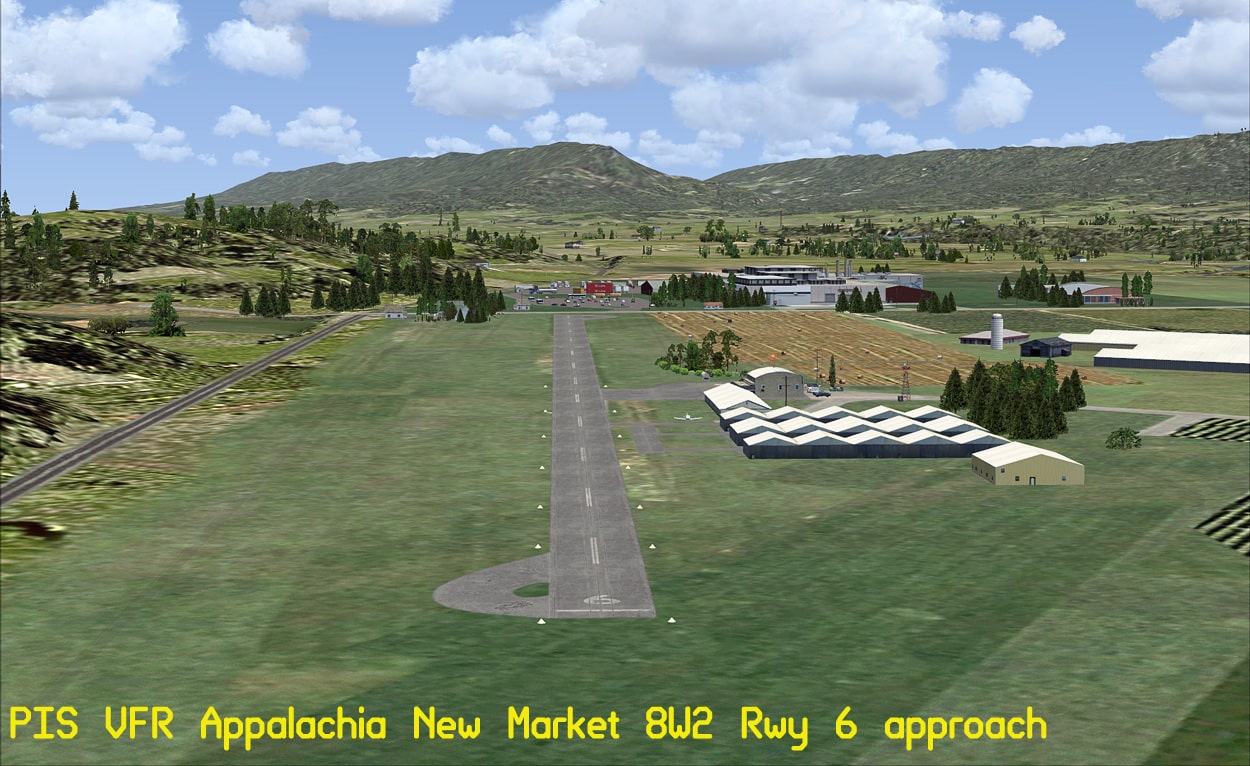
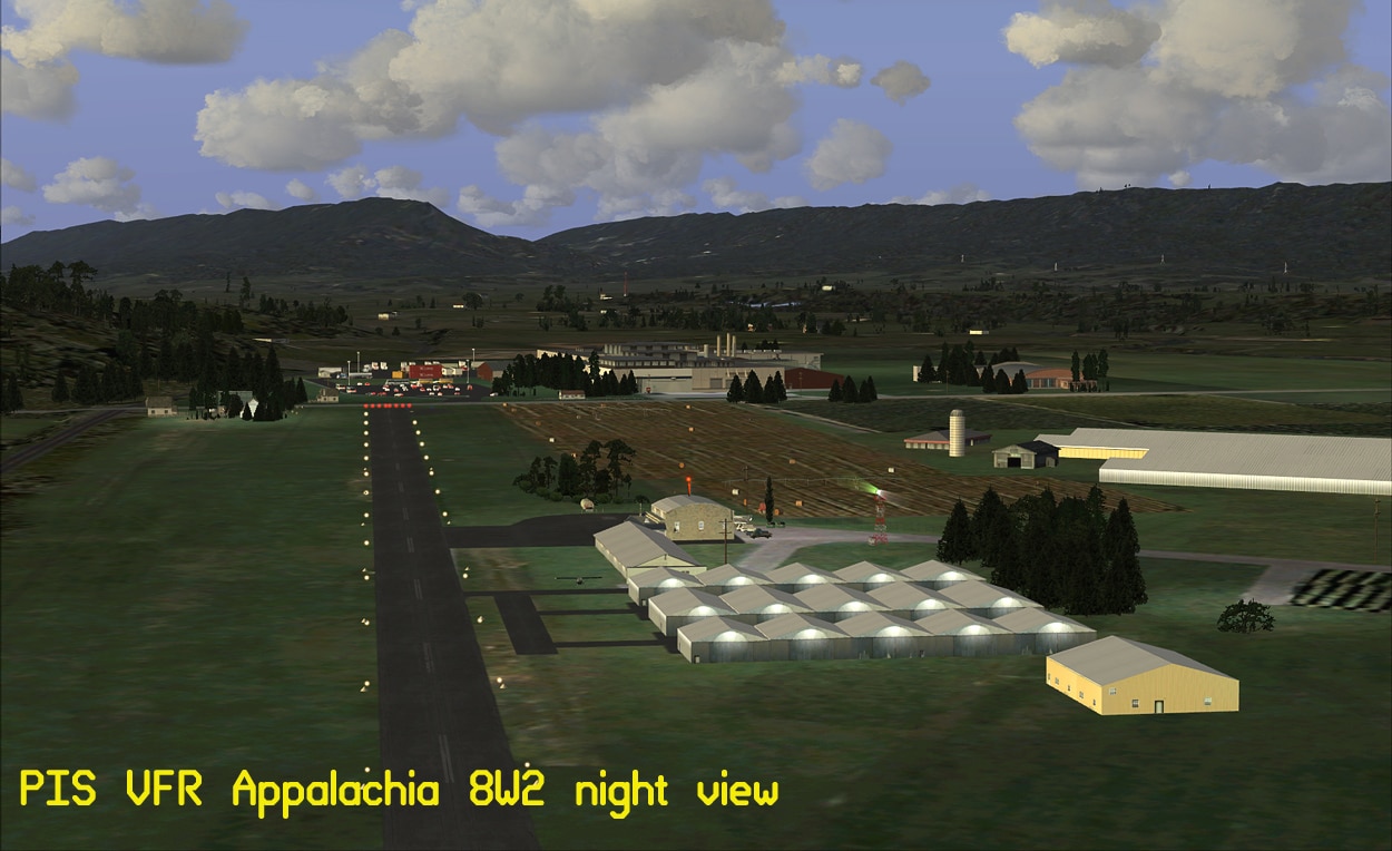
- New Market (8W2), Virginia
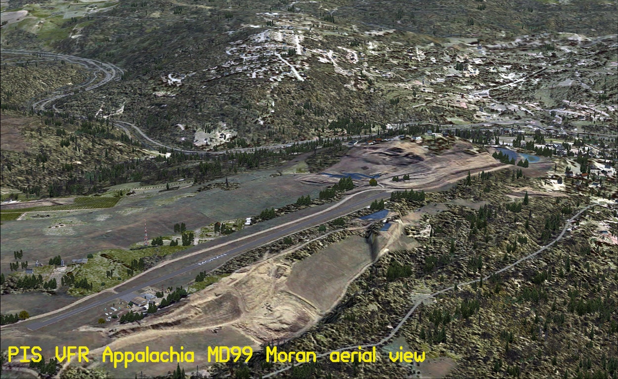
- Moran Field (MD99), Maryland
- Seven Springs Borough (7SP), Pennsylvania
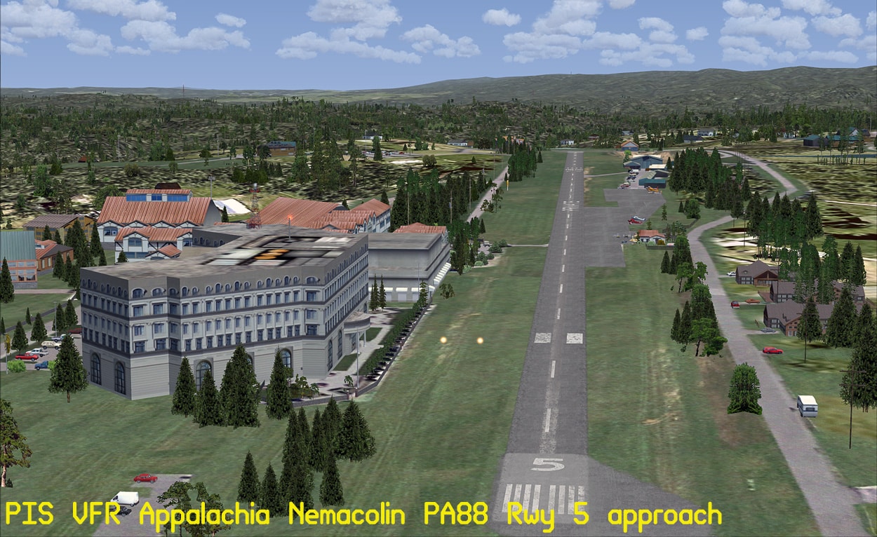
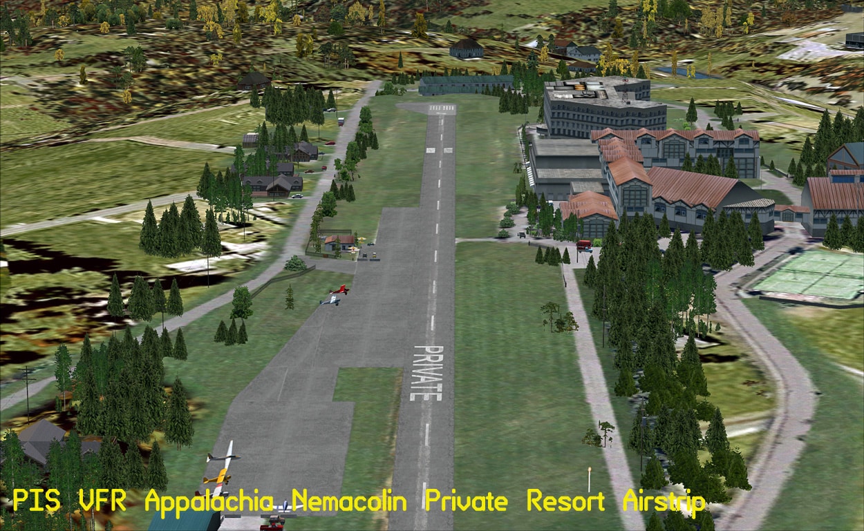
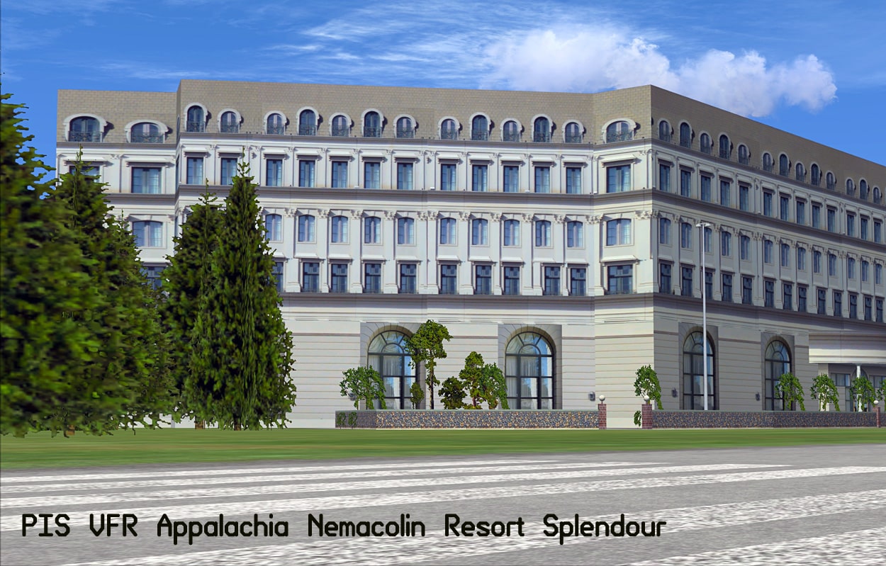
- Nemacolin Resort (PA88), Pennsylvania
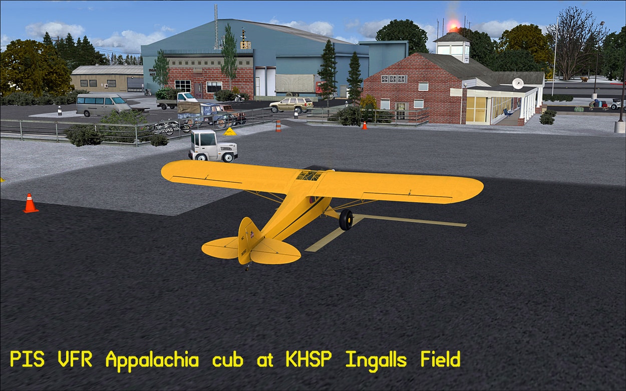
- Ingalls Field (KHSP), Virginia
In the real world some of these airfields may have been decommissioned and no longer exist as places to land but they are quite challenging to bring your plane down in one piece. Cheat River for example no longer exists but you can still see its outline in Google Earth.
Visually speaking:
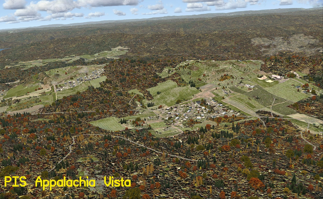
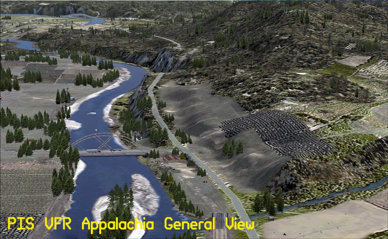
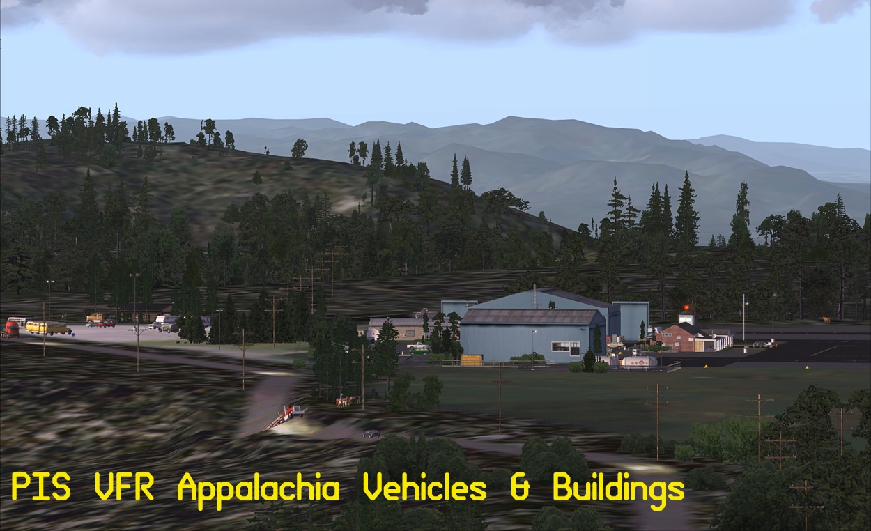
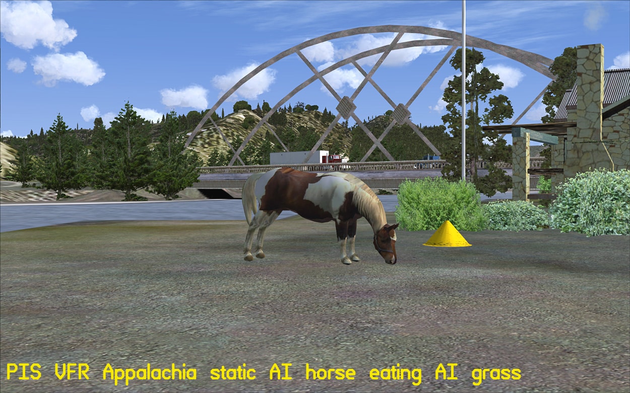
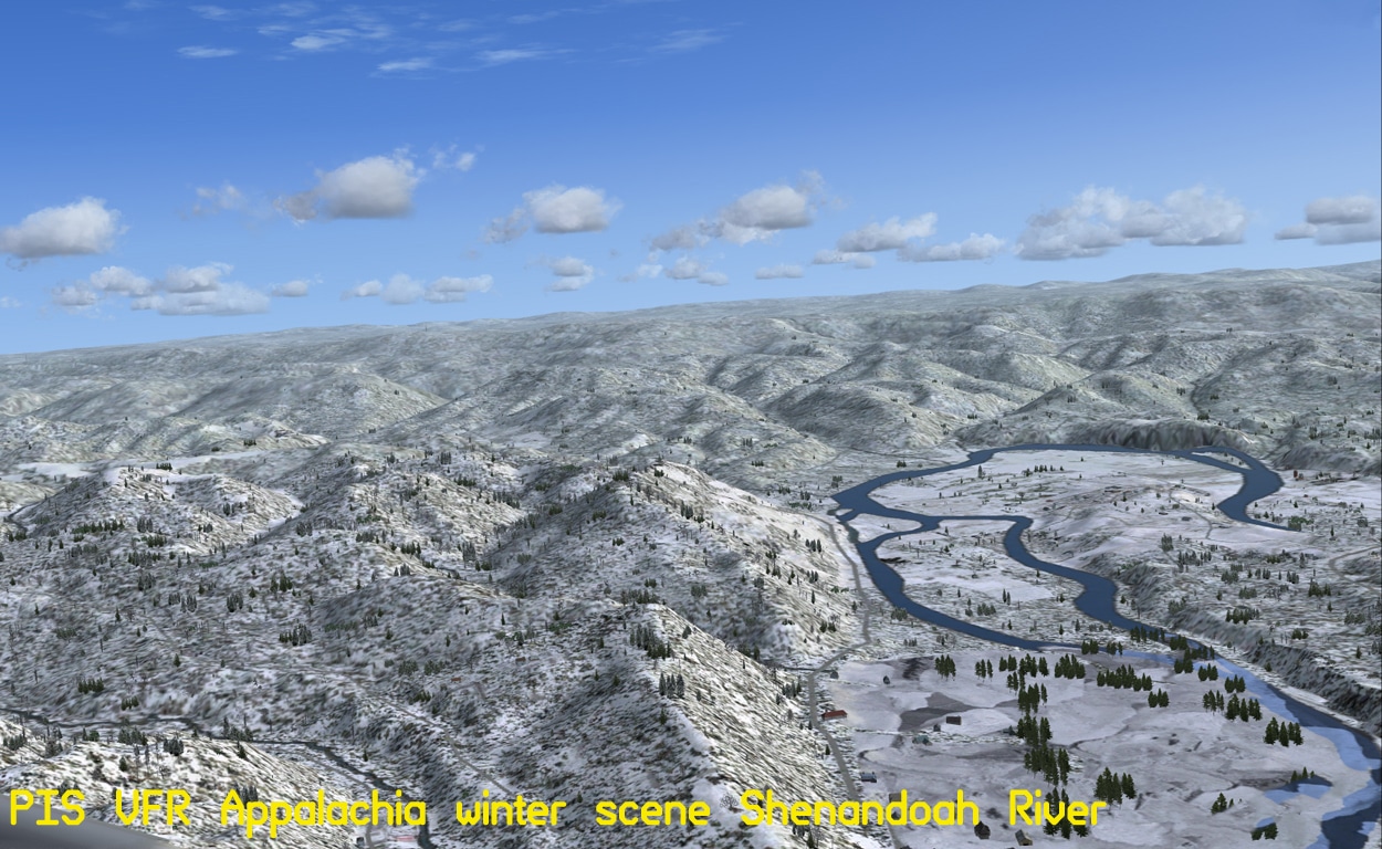
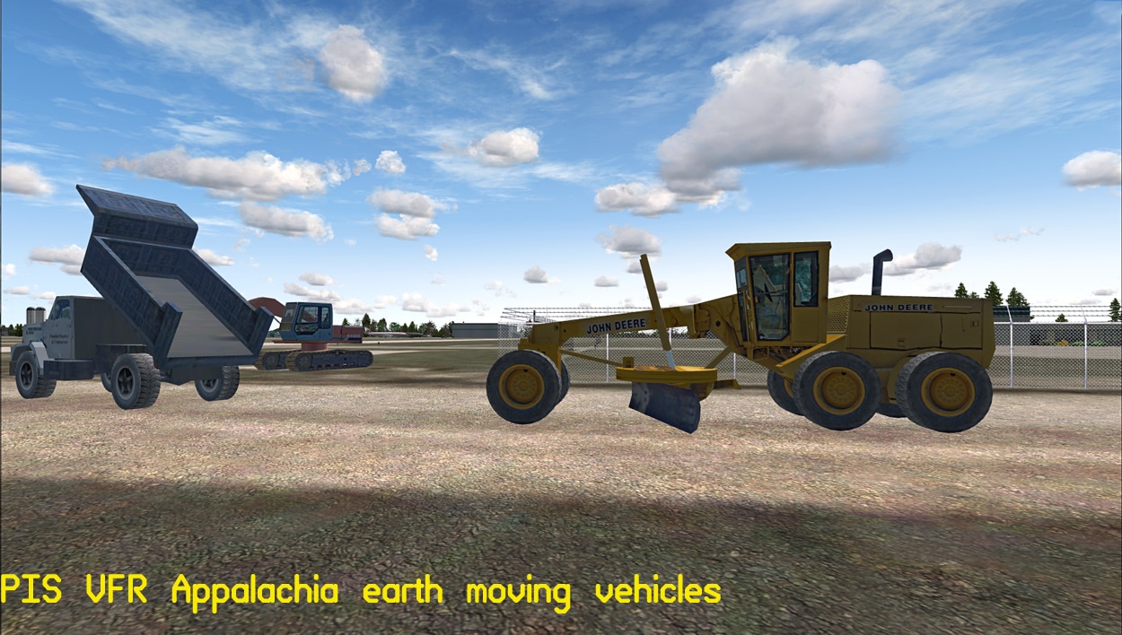
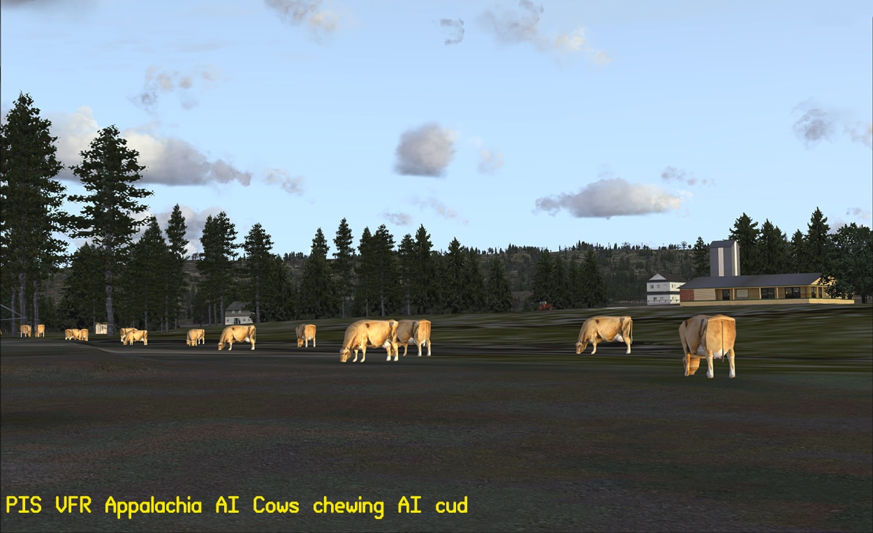
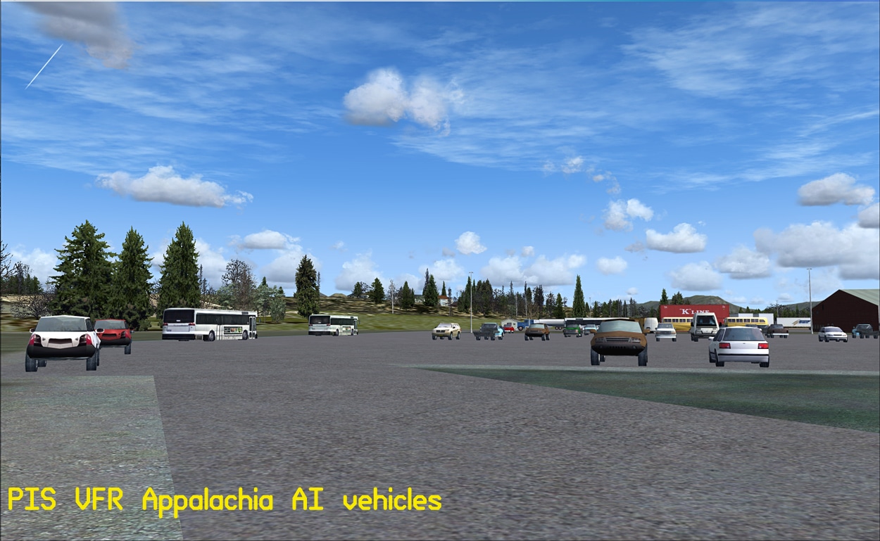
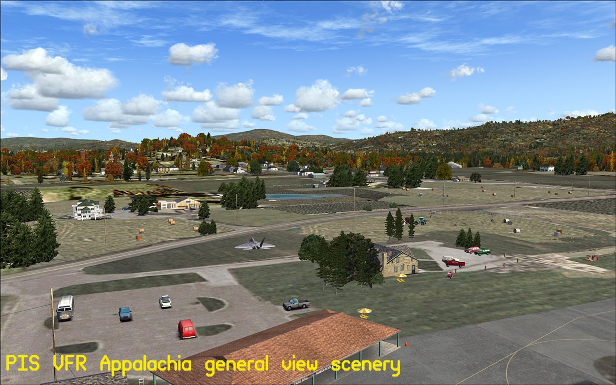
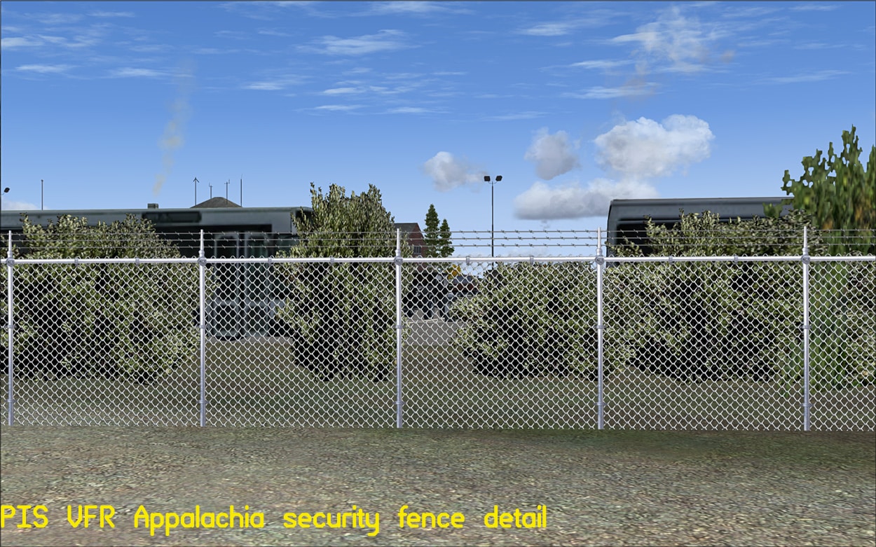
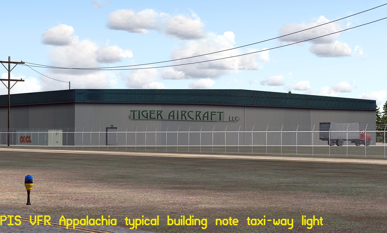
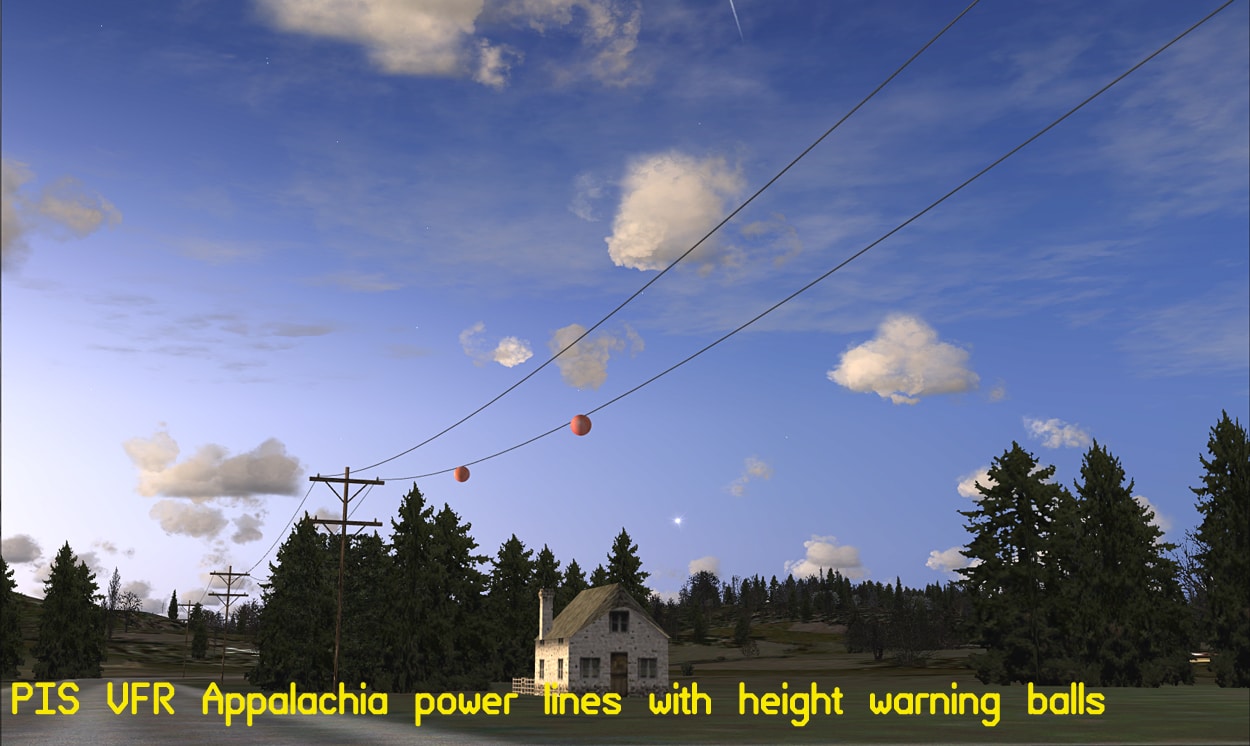
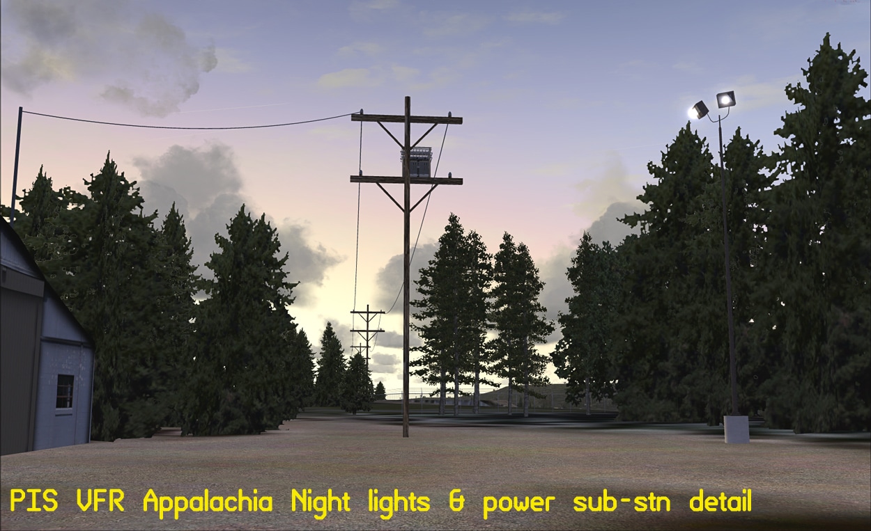
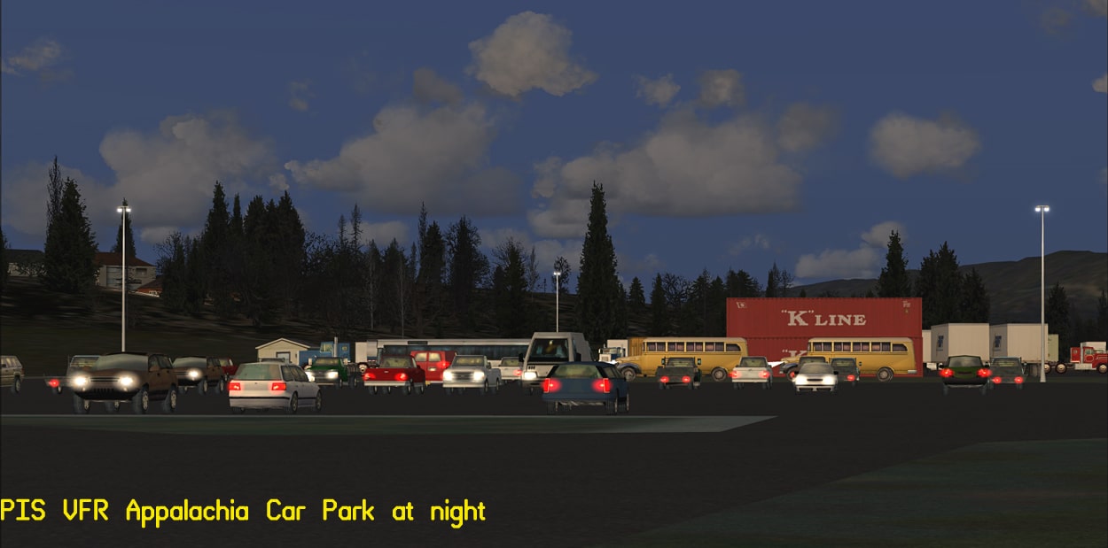
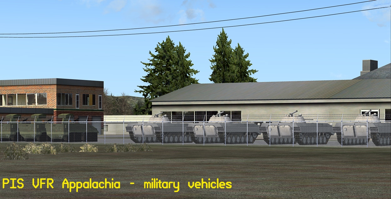
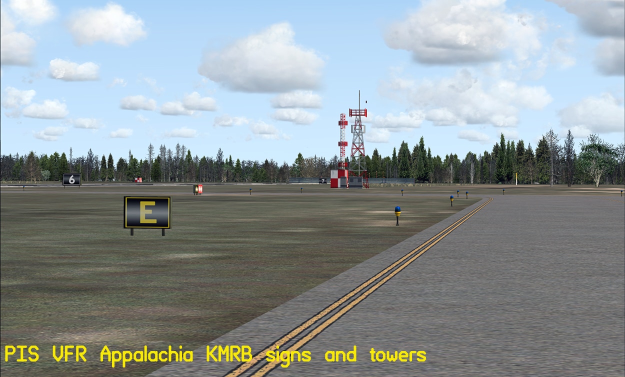
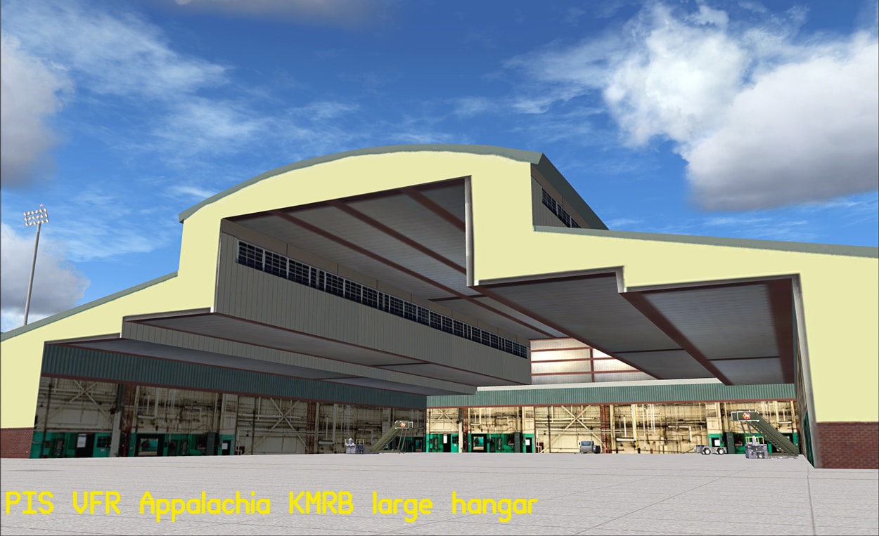
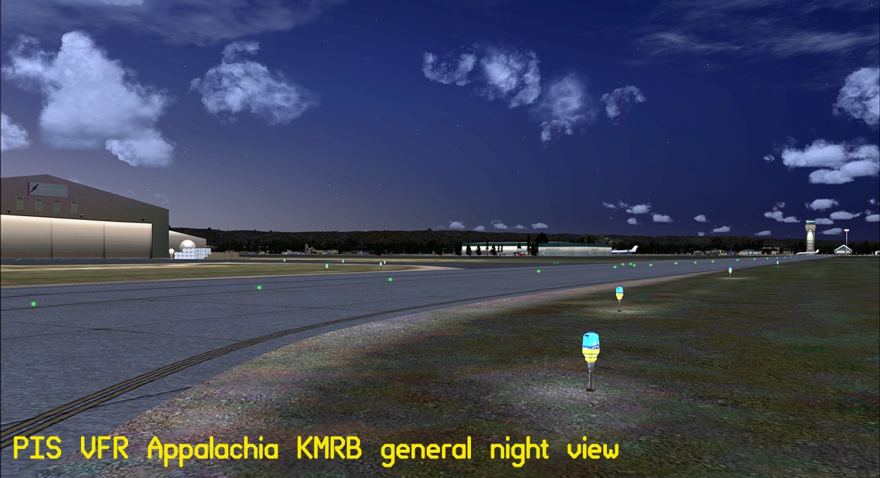
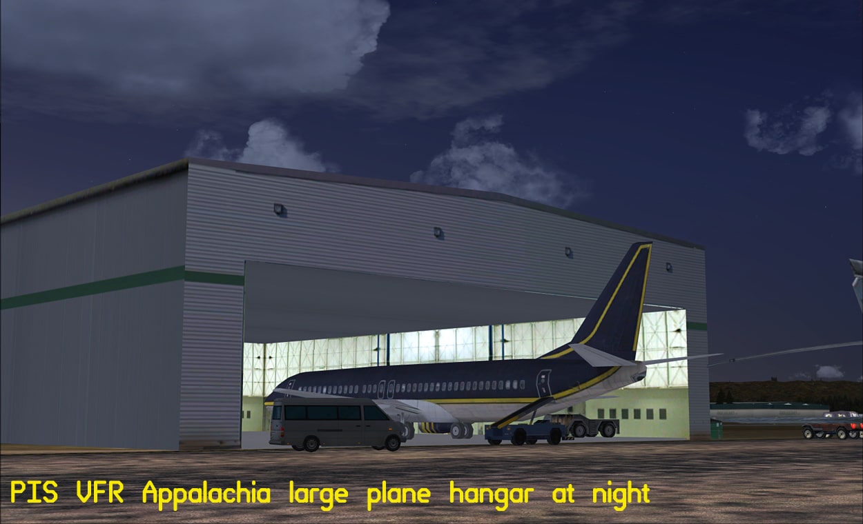
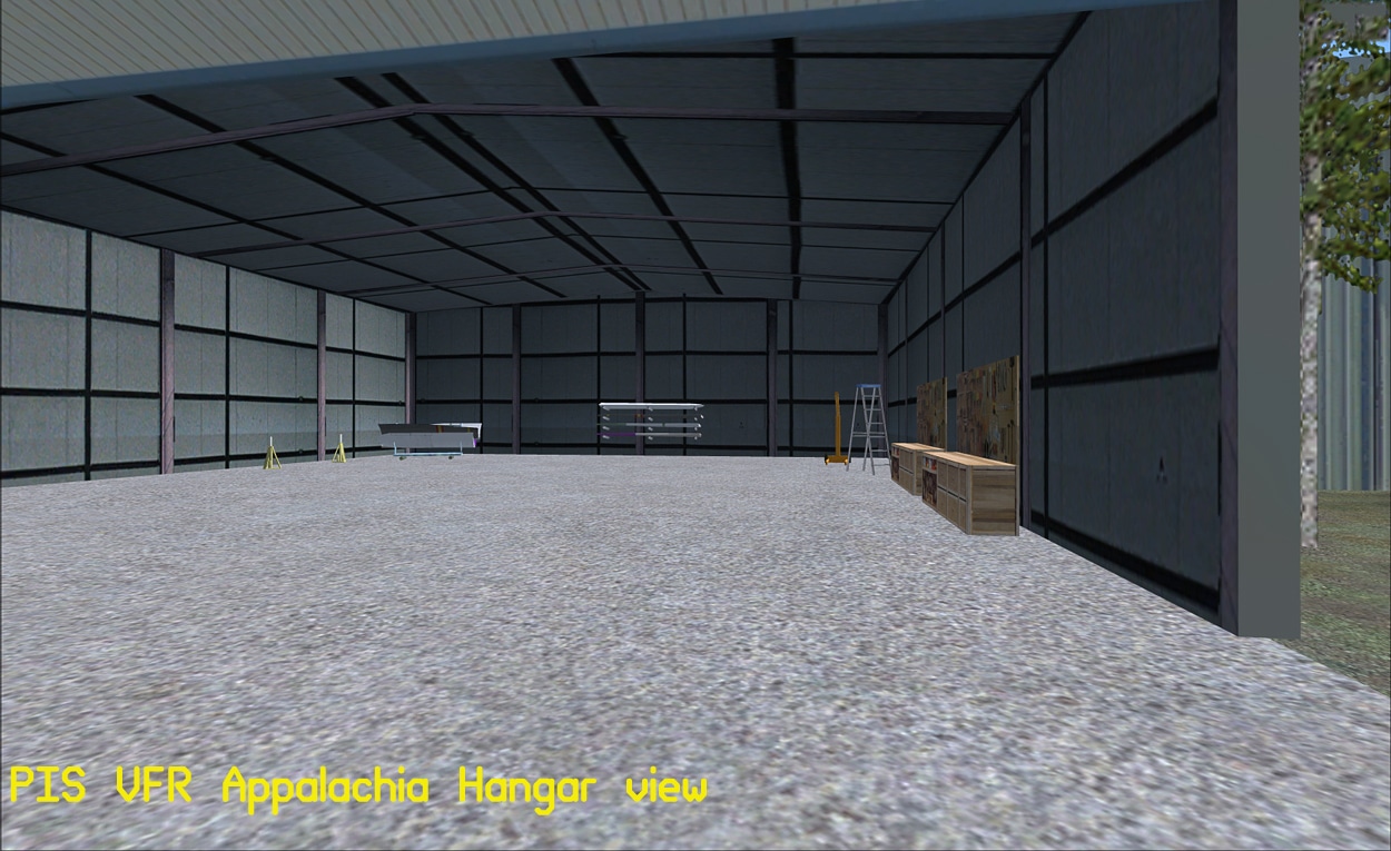
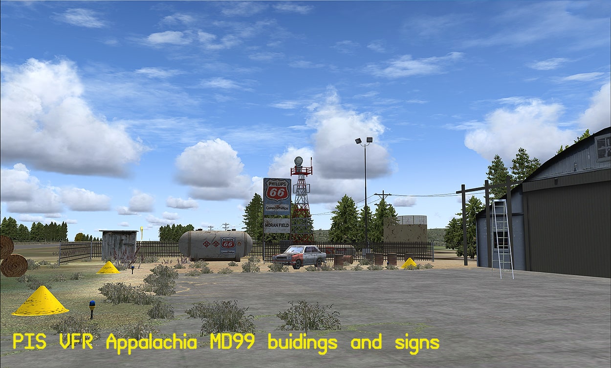
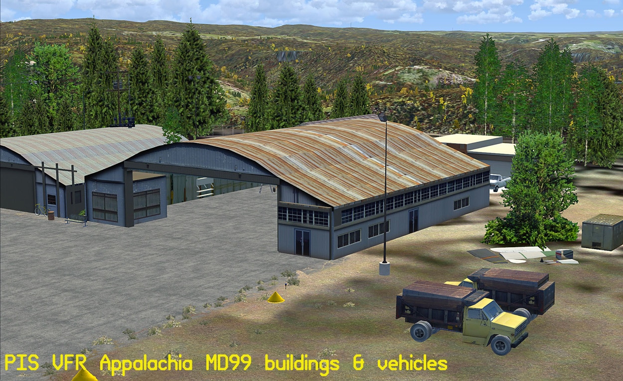
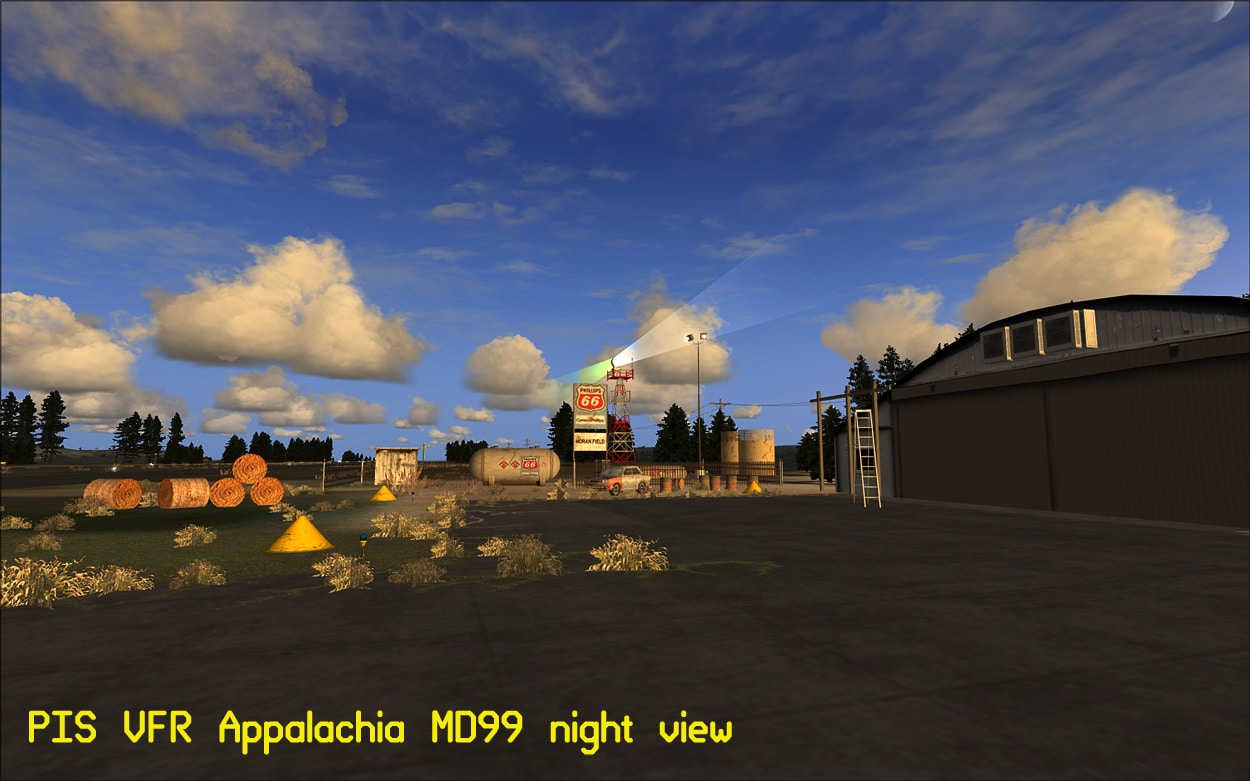
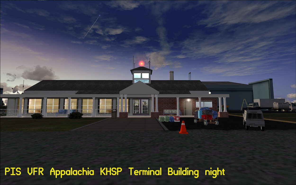
As I state above PIS covers a certain portion of the Appalachia Region and it transforms the default scenery into something approaching what we would see if we visited the area. The eight airstrips are faithfully reproduced and there are animated and static vehicles in and around them. Using the recommended settings we see huge areas of forests, mountains, bridges, roads, creeks streams and rivers placed geographically accurately. The scenery package is best displayed in the summer or spring around dusk or dawn and the fall colours are also effective. As is usual with PIS scenery there are lots of flying birds as well as animals populating the scenery coverage area, animals I spotted so far include horses and cattle and items. There are also power poles, great lighting effects, car parks, factories, hangars, in fact all the objects and buildings you would expect to see around these airfields. Some of the airfields double as military airfields and here PIS has modelled military aircraft, helicopters, vehicles and even tanks! There may have even been a hum vee or two dotted around.

The Airfields (detail): (Airfield details courtesy: Airnav):
PIS have modelled8 airfields that have been remodelled and repositioned to look more realistic, they are a significant increase in quality and realism over the default FSX airfields in the same area. In the real world some are no longer in action and that is mentioned in the manual.
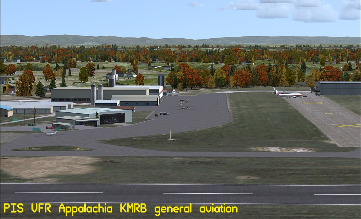
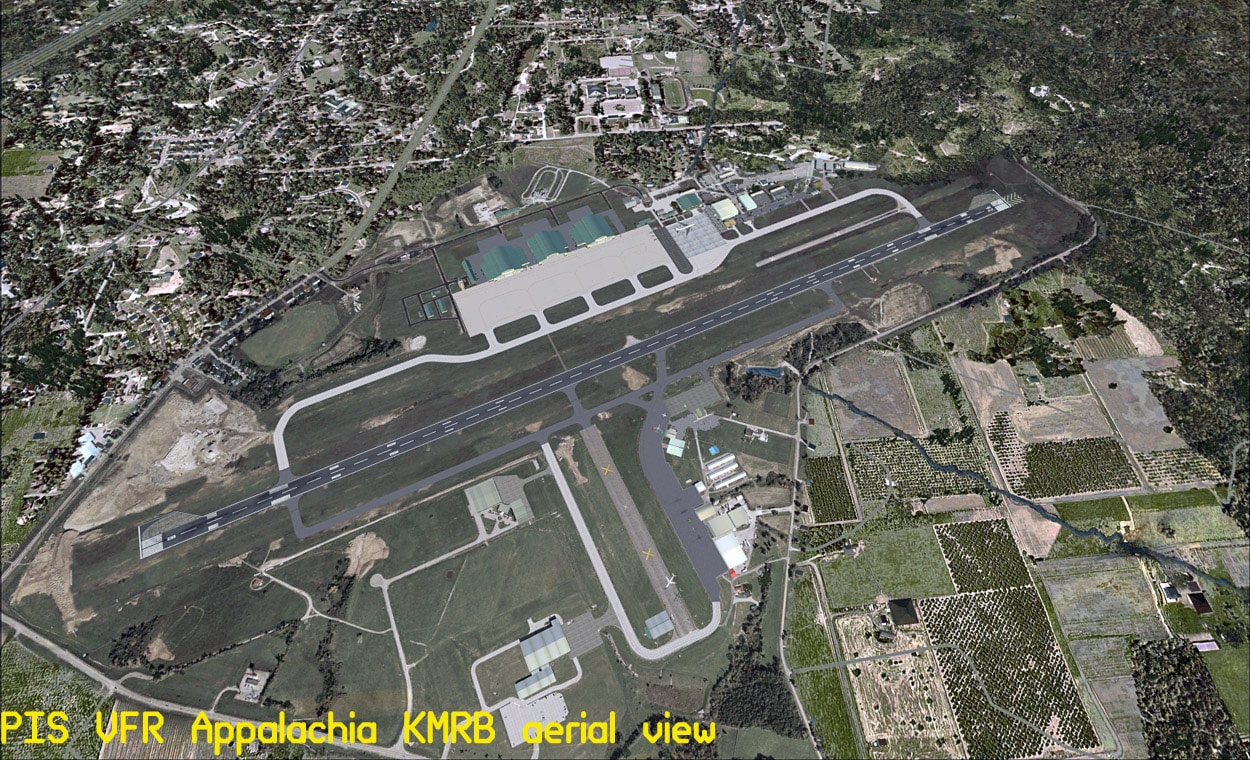
Eastern West Virginia Regional Airport/Shepherd Field (KMRB), West Virginia:
This is a is a joint civil-military public airport located four miles (6 km) from Martinsburg West Virginia. It has a single asphalt runway, 08/26, 2382 m (7,000′) long, elevation 170′, strengthened recently to take heavier larger aircraft such as the c5 Galaxy.
Cheat River (WV31), West Virginia:
This is a defunct grass airstrip located just outside St George, WV. Being in a river valley surrounded by mountains and rough terrain makes this a challenging airstrip to land on or take-off from.

Front Royal Warren County (KFRR), Virginia:
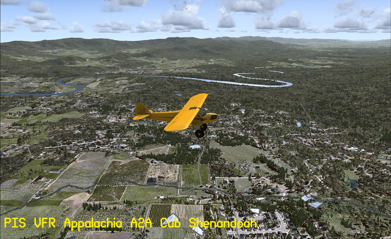
This is the airstrip/airfield/airport for the small town of Front Royal in Virginia ≈80 miles from Washington, DC. It has a single asphalt runway 09/27, 3010′ long at an elevation of 710′. This airport gives unrivalled views of the Blue Ridge Mountains and the mind blowing scenery of the Shenandoah Valley.
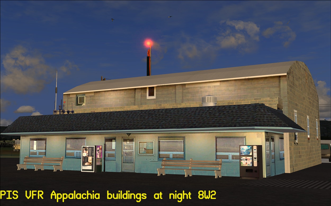
New Market (8W2), Virginia:
This is the airstrip/airfield/airport for the small town of New Market (2 miles away) in Virginia ≈a 2 hour drive from Washington, DC. It has a single asphalt or bituminous concrete runway 06/24, 2920′ long at an elevation of 975′. Again a great place to explore the Shenandoah Valley.
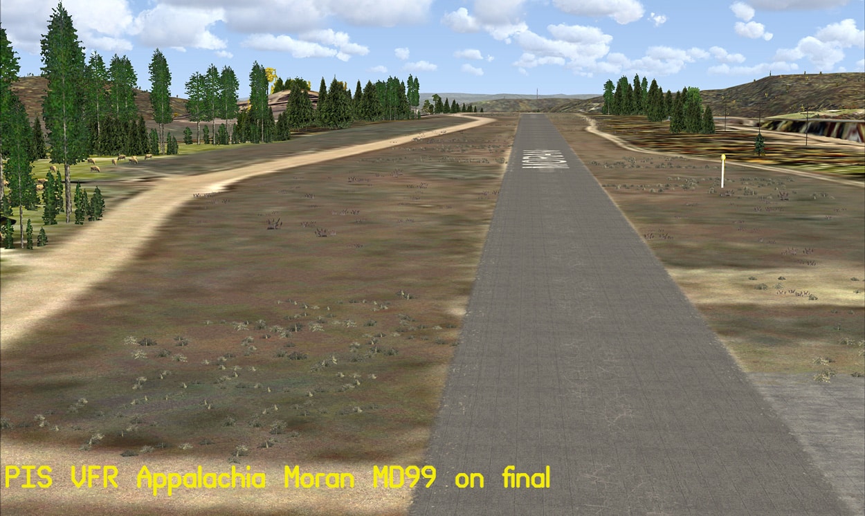
Moran Field (MD99), Maryland:
This airfield services the small town of Westernport in Allegany County, MD. It had a single asphalt runway 14/32, xxxx’ long at an elevation of 2100′.
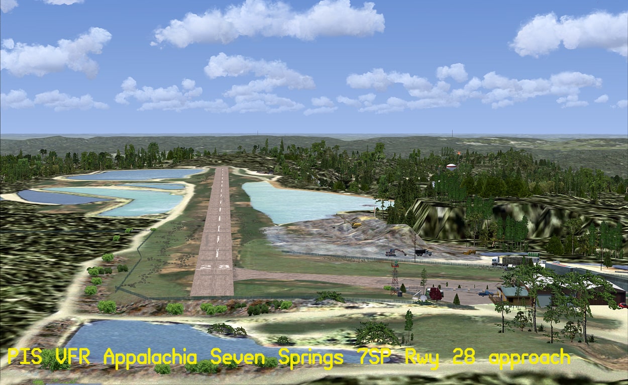
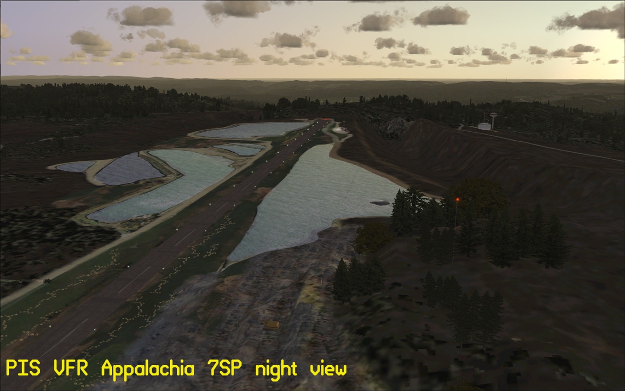
Seven Springs Borough (7SP), Pennsylvania:
This decommissioned/closed indefinitely airfield used to serve the small borough of Seven Springs in borough in Somerset and Fayette Counties, Pennsylvania. It had a single paved runway 10/28, 3045′ long at an elevation of 2907′, 1 mile SW of the town. The area is renowned for the Seven Springs Mountain Resort, and activities offered at the resort include, fishing, hiking, and golfing skiing and snowboarding.
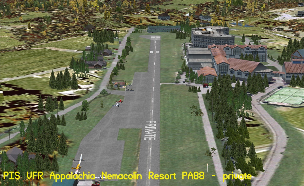
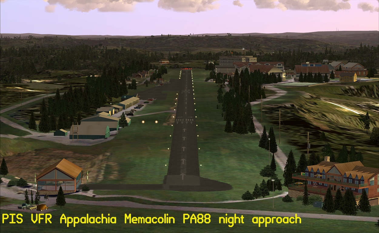
Nemacolin (Resort) Airport, Farmington (PA88), Pennsylvania:
The airport services the very successful Nemacolin Woodlands Resort which occupies 2000 woodland acres in Farmington, Fayette County, Pennsylvania. It has a single (PRIVATE) asphalt runway 05/23, 3980′ long at an elevation of ≈2010′, about 0.6 mile from Farmington which is ≈ 50 miles SE of Pittsburgh. The resort is famous for golf and other outdoor pursuits. The golf course is well modelled in PIS VFR Appalachia.
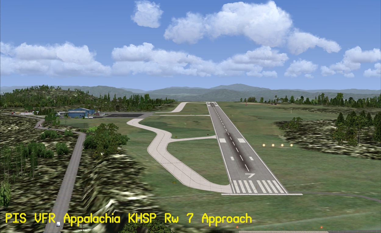
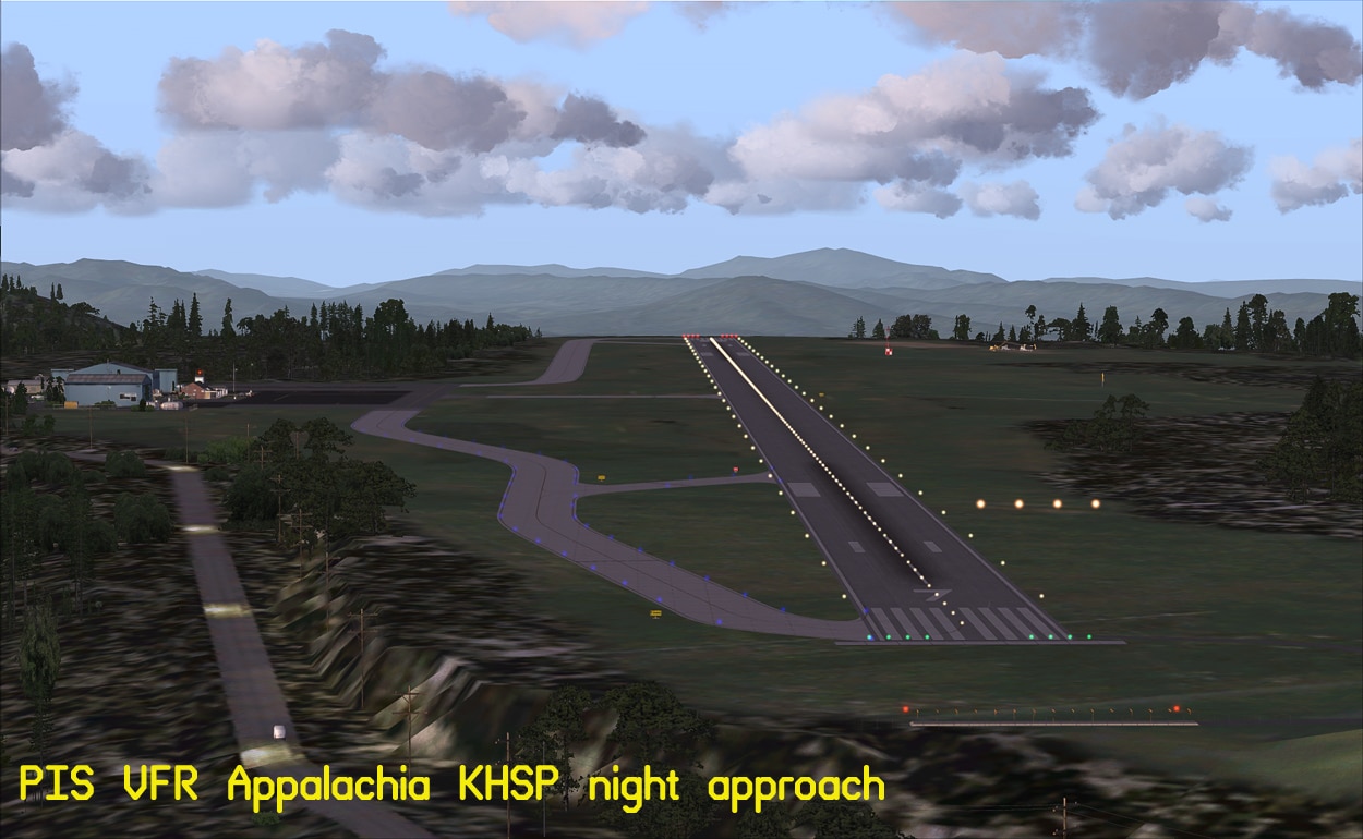
Ingalls Field Hot Springs (KHSP), Virginia:
The airport services the world famous Homestead Spa situated in Hot Springs, Va. It has a single asphalt runway 07/25, 5600′ long at an elevation of 3793′, about 3 miles south of Hot Springs which is ≈ 60 miles from Lexington, Va. Again the homestead being a mountain resort offers a wide variety of indoor leisure activities and outdoor pursuits, including golf, fishing and skiing.
Overall:
All the runways are well modelled with the various textures e.g. asphalt, grass textures, photoreal ground textures (see pictures above). Some of the airfields are quite tricky to get in or out of.
Roads, Bridges, Vegetation, and AI traffic:
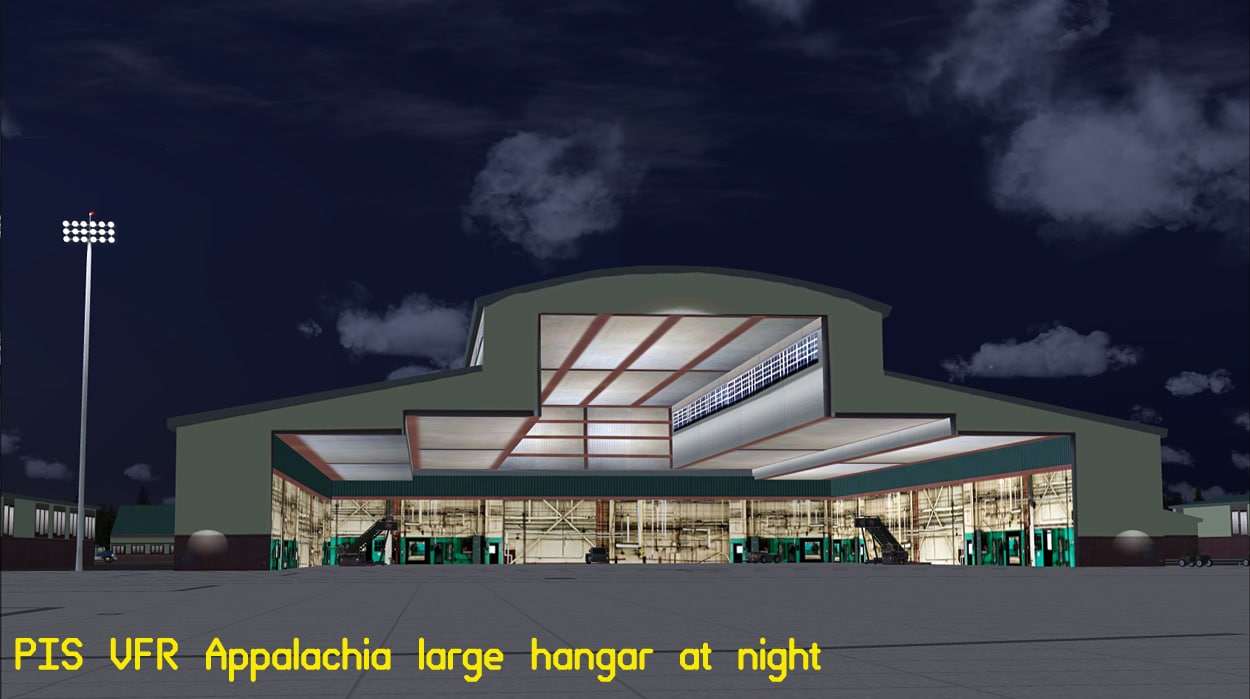
These are depicted accurately in the software, being quite numerous throughout the area with many having moving AI vehicles.  The vegetation is quite dense and well represented, very typical of a mountain bush region. The landclass and water textures are well drawn as are the seasonal changes with great night texture effects and the grass effects are always nice to see.
Sounds:
These are mainly the birds, I didn’t notice other AI sounds but in my ORBX “BOB” settings I heard voices in the background, AI machinery and aircraft sounds, very realistic.
Support:
This is by email and if my experience is anything to go by it is one of the best support systems offered. Graham always gives you a prompt reply and includes lucid explanations to solve any issues that you might experience. I had no issues with the scenery per se, my questions were more of an inquisitive nature as to why PIS had modelled this airfield, feature, or not, as the case may be.
Summing Up:
This is another nice add-on for FSX from PIS, and my brief review is just that brief and there was a lot undiscovered ‘goodies that I didn’t cover. As I have said on many previous occasions, every time that I flew I saw something new. The airfields, etc are well represented and are great to fly in and out of. This is definitely a VFR package and I used the slowest aircraft (A2A Cub and ORBX “BOB”) in FSX to experience the various sights and sounds. As a senior pilot (not a captain you notice) of Greenbrier Virtual Aviation (GVA), this VFR Appalachia has special significance for me in that it is an area that I fly regularly in and this package will enhance that experience. Now if I can only persuade Graham to model KLWB and the rest of Appalachia, all would be complete! Another keeper!
WOW Factor: 9 out of 10
Peter Hayes, Australia, January 2011
A Collection of the Important Bits:
- Publisher: Pacific Islands Simulation, LLC
- Supplier: simMarket
- Download File Size: ≈584MB (exe file)
- Installed File Size: ≈1.05GB
- Simulator Requirement: FSX SP1, SP2 (Acceleration/Gold)
- OS Requirements: Win XP, Vista and/or Win 7;
- Testing System: Intel E8600, 4GB DDR 800 RAM, Vista 64 SP2, nVidia GTX260 GT,
nVidia 258.96 Driver; FSX SP1 + SP2; 500GB SATA II Seagate Momentus X HDD.Â
No tweaks all standard and no over-clocking. - Scenery: FSX Default; FS Genesis, UTX USA/Canada; GEXn; X-Graphics, plus OrbX “BOB”
- Installation: Automatic via a self extracting “exe” file, entering a key code.
- Manual: One manual (user guide) 6pp
- Demo: N/A
- Support: toksawe@gmail.com
- Homepage: http://www.islandsim.com
- Forum: http://islandsim.com/pis_forum/
- Updates N/A
- Uninstall None
![[Video🎬] New Trailer 4K for Turkish Airports MSFS by SceneryTR Design – Istanbul – Ankara Trabzon by SIMMARKET](https://www.simflight.com/wp-content/uploads/2024/04/SceneryTR_thumb.jpg)

0 Responses
I read the review of VFR Appalachia with great interest and appreciation that someone has finally recognized our beautiful section of the U.S as being worthy of addition to the FSX stage. However I must take issue with the quoted text from Wikipedia (not the reviewer of this beautiful programming addition). While the author of the Wikipedia article may include some part of New York State as part of Appalachia, I can definitely state that here in deep Appalachia (West Virginia) we most certainly have no desire to include NY State as part of our realm. Just a few brief words as to what constitutes the area known as “Appalachia”.